MAPfrappe
Compare areas on Google Maps
Pages
Home
Index of Outlines
Sunday, June 17, 2012
Hydroelectric Dams and Reservoirs
Some of the largest hydroelectric dams in the world and their reservoirs, as compared to Tokyo on
MAPfrappe.com
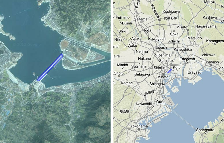
Three Gorges Dam (China) compared to Tokyo
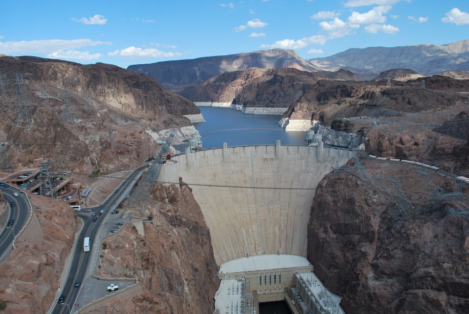
Hoover Dam and Lake Mead (United States) compared to Tokyo
dj
Daniel-Johnson Dam & Manicouagan Reservoir (Canada) compared to Tokyo
Guri Dam (Venezuela) compared to Tokyo
Tucuruí Dam (Brazil) compared to Tokyo
Fort Peck Dam (United States) compared to Tokyo
Churchill Dam and Smallwood Reservoir (Canada) compared to Tokyo
Itaipu Dam (Paraguay) compared to Tokyo
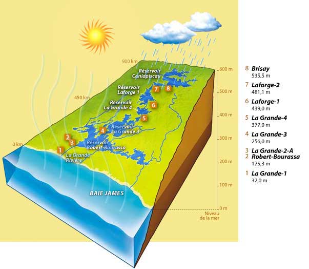
James Bay Project (8 generating stations) on La Grande River (Canada) compared to Tokyo
Akosombo Dam and Lake Volta (Ghana) compared to Tokyo
Tuesday, July 5, 2011
Europe
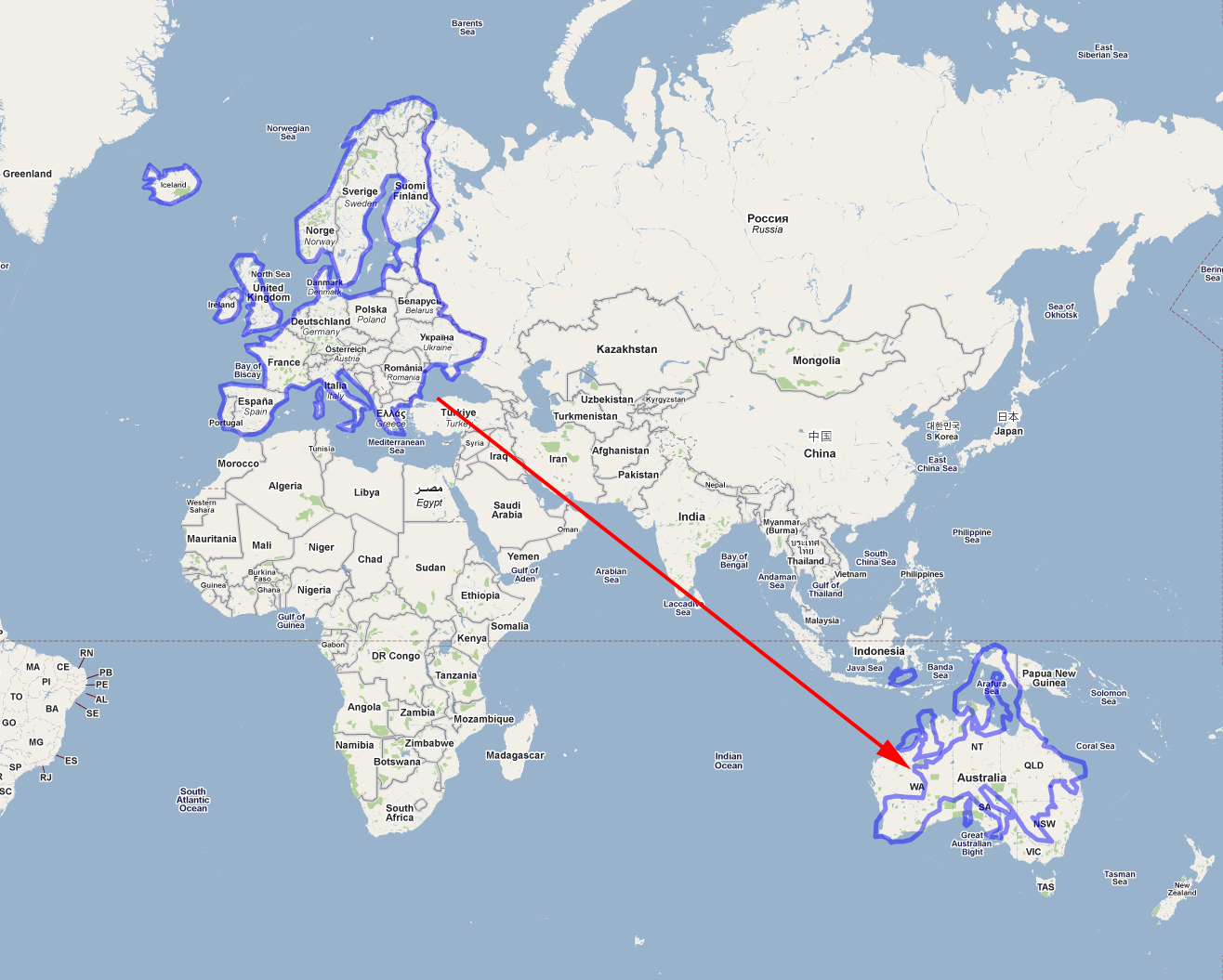
The area of Europe at its high latitude is made to look much larger than it actually is on a map based on the Mercator projection:
Europe compared to Australia
Western Europe compared to Africa
COUNTRIES
Austria compared to Montana
Belgium compared to Congo and Rwanda
Britain compared to South Korea
Cyprus compared to Los Angeles
France compared to Quebec
Germany compared to Texas
Iceland compared to Ecuador
Ireland compared to West Virginia
Italy compared to Western United States
Liechtenstein compared to San Francisco
Luxembourg compared to Hong Kong and Shenzhen
Malta compared to Las Vegas
Netherlands compared to Ghana
Norway compared to New Zealand
Poland compared to Alaska
Portugal compared to Brazil
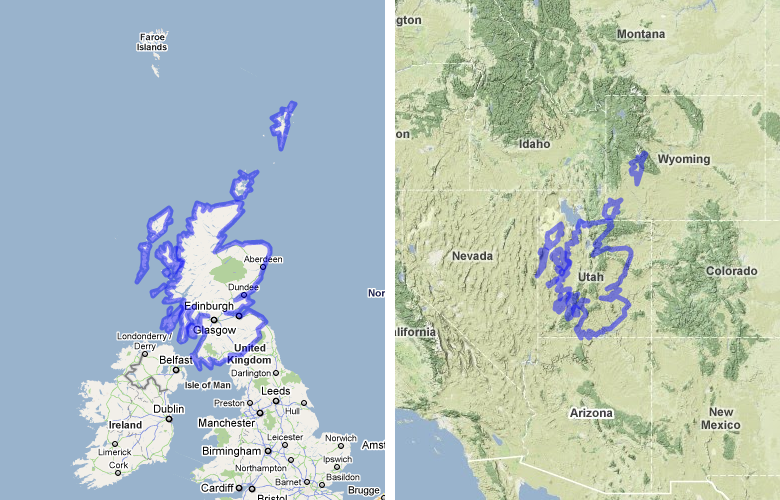
Scotland compared to Utah
Spain compared to Venezuela
Sweden compared to Japan
Switzerland compared to Iceland
Ukraine compared to China
United Kingdom compared to Madagascar
Vatican City compared to Central Park New York City
CITIES AND LANDMARKS
Amsterdam compared to Vansterdam (Vancouver, Canada)
Berlin compared to Tokyo
Brussels compared to Washington DC
London compared to New York
Madrid compared to Mexico City
Manchester compared to Atlanta
Munich compared to Denver
Paris compared to Montreal
Reykjavik compared to Toronto
Rome compared to Athens
Stockholm compared to Dubai
Venice compared to New Orleans
Vienna compared to Moscow
The Eiffel Tower Paris compared to the replica Eiffel Tower at Paris Hotel Las Vegas
Millau Viaduct Bridge compared to the Golden Gate Bridge
Make your own outline and save it on
MAPfrappe
for free! Or, view one of the hundreds of previously saved outlines from the
MAPfrappe index
Older Posts
Home
Subscribe to:
Posts (Atom)